Official Regulations
To find all the laws and regulations governing hunting in California visit the California Department of Fish and Wildlife Website. For information about coyotes look for regulations for hunting non-game animals.
Hunting License
A hunting license is required when taking coyotes in California. You can purchase a license for the year or if you are going on a short trip you can get a two-day license for about 1/4 of the cost of an annual license.
Season Dates and Bag Limits

There are no season dates associated with coyotes, they may be taken any time of the year. Also, there are no limits on how many coyotes you can take.
Loaded Firearms
It is unlawful to carry a loaded firearm (round in the chamber) in or on any vehicle in California. You also have to have the magazine empty if it is installed in the firearm. You can have a magazine loaded, but can’t have it close to the firearm during transport.
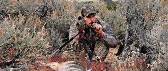
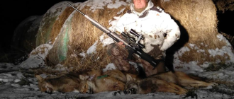
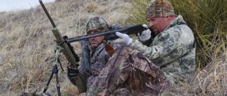
Night Hunting
Night hunting is legal except in the following area:
(a) Area Closed to Night Hunting. Non-game mammals may be taken only between one-half hour before sunrise and one-half hour after sunset in the following described area: Beginning at a point where Little Panoche Road crosses Interstate 5 near Mendota; south on Interstate 5 to Highway 198; east on Highway 198 to Highway 99; south on Highway 99 to Interstate 5; south on Interstate 5 to the Los Padres National Forest boundary in Section 8, T 9 N, R 19 W, S.B.B.M near Fort Tejon Historical Monument; west along the National Forest boundary to Cerro Noroeste Road; northwest on Cerro Noroeste Road to Highway 33-166; north on Highway 33-166 to the Soda Lake Road; northwest on the Soda Lake Road and on the Simmler Soda Lake San Diego Creek Road to Highway 58 at Simmler; west on Highway 58 to the Cammotti Shandon Road; north on the Cammotti Shandon Road to the Shandon San Juan Road; north on the Shandon San Juan Road to Highway 41; northeast on Highway 41 to the Cholame Valley Road; northwest on Cholame Valley Road and Cholame Road to the Parkfield Coalinga Road in Parkfield; north on Parkfield Coalinga Road and Parkfield Grade to Highway 198; northwest on Highway 198 to the Fresno-Monterey county line; north along the Fresno-Monterey county and Fresno-San Benito county lines to the Little Panoche Road; north and east on the Little Panoche Road to the point of beginning at Interstate 5
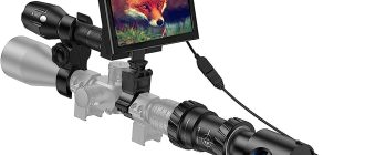
Use of Lights at Night
Lights of any size or voltage may be used to take furbearing or non-game mammals only in the areas described in subsections (b) and (c) below, and only under the following conditions:
(1) The use of lights for night hunting is prohibited in any area where the general deer season is open.
(2) Furbearing mammals and non-game mammals may be taken with the aid of a spotlight or other artificial light operated from a vehicle provided such vehicle is stopped and standing with the motor off. No spotlight may be used from a vehicle which is on a public road or highway.
(b) Zone 1. (Portions of Butte, Colusa, Glenn, Placer, Sacramento, Sutter, Tehama, Yolo and Yuba counties.)
Area: Within the boundary beginning at the junction of Interstate 880 and Interstate 5 near Sacramento; east on Interstate 880 to its junction with Interstate 80; north and east on Interstate 80 to its junction with Highway 65 near Roseville, along Highway 65 to its junction with Highway 20 at Marysville; west on Highway 20 to its junction with Highway 45; north on Highway 45 to its junction with Highway 162; east on Highway 162 to its junction with Highway 99; north on Highway 99 to South Avenue near the town of Corning; west on South Avenue to Interstate 5 in Corning; north on Interstate 5 to Corning Road; west on Corning Road to Paskenta Road; west on the Paskenta Road to the town of Paskenta; southwest on the Round Valley Road to the Garland Road; south on the Garland Road to the town of Newville; south on the Newville-Elk Creek Road to the town of Elk Creek; south on the Elk Creek-Stonyford Road to the town of Stonyford; south on the Stonyford-Leesville Road to the town of Ladoga; south on the Stonyford-Leesville Road to the town of Leesville; south from Leesville on the Bear Valley Road to its intersection with Highway 20; east on Highway 20 to its intersection with Highway 16; south and east on Highway 16 to its intersection with Interstate 5; east on Interstate 5 to Interstate 880 and the point of beginning.
(c) Zone 2. (Portions of Inyo, Kern, Los Angeles, Mono and San Bernardino counties and all of Imperial, Orange, Riverside and San Diego counties.)
Area: Inyo, Mono and Kern counties south and east of a line beginning at the junction of Highway 182 and the California-Nevada state line; south on Highway 182 to its junction with Highway 395; south on Highway 395 to its intersection with Highway 168 at Bishop; west on Highway 168 to its intersection with the Inyo National Forest boundary; south on the Inyo National Forest boundary to its junction with County Highway J41; south and east on County Highway J41 to its junction with Highway 395; south on Highway 395 to its junction with Highway 14 near Inyokern; south on Highway 14 to its junction with Highway 178 at Freeman; west on Highway 178 to its junction with the Bodfish-Caliente Road at Isabella; south on the Bodfish-Caliente Road to its junction with Highway 58; east on Highway 58 to its junction with the Los Angeles Aqueduct; south and west on the Los Angeles Aqueduct Road to its junction with 265th Street West near Neenach; south on 265th Street West to its junction with the Elizabeth Lake-Pine Canyon Road at Three Points; east along the Elizabeth Lake-Pine Canyon Road to its junction with Highway 14 at Palmdale; south on Highway 14 to its intersection with the Angeles Forest Highway; south on the Angeles Forest Highway to the Mill Creek Summit Road; east and south on the Mill Creek Summit Road to its intersection with the Angeles Crest Highway (Highway 2) at Upper Chilao Campground; east on the Angeles Crest Highway to its intersection with the Los Angeles-San Bernardino county line; north on the Los Angeles-Kern-San Bernardino county line to its intersection with Highway 58; east on Highway 58 to its intersection with the range line between R3W and R4W; south along the range line between R3W and R4W to the southeast corner of T8N, R4W; east along T8N to its intersection with the west boundary of the U.S. Marine Corps Training Center; south and east on that boundary to its intersection with Giant Rock Road; east along Giant Rock Road to a point where it turns southeast and corresponding with a projected north extension of Sunfair Road; south on Sunfair Road and its projected extension to the San Bernardino-Riverside county line; and all of Imperial, Orange, Riverside and San Diego counties.
Transporting
You do not need a license in order to transport coyotes or export coyotes from California.
Selling
If you are selling the fur in California you will need a furbearers permit.